Trails
Bamford bus stop to Hope bus stop via Win Hill Walk
This is a delightful 5.3 mile walk that can be easily accessed by bus.
About
This is a delightful 5.3 mile walk from Bamford to Hope via the rocky heights of Win Hill (464m). It includes a few challenges but rewards you immensely for every step of effort! From the pretty village of Bamford, the route takes you on well-made tracks to the shores of the iconic Ladybower Reservoir, passing the famous ‘plugholes’. It then heads up on field paths to the summit of Win Hill, offering incredible 360 degree views across the Upper Derwent Valley, the Hope Valley and the Kinder plateau. The route finally drops down on field paths and country lanes into the village of Hope.
This walk starts and ends at bus stops on the Travel South Yorkshire Route 272 between Sheffield and Castleton, and passes close to train stations on the Hope Valley line, so it’s the perfect way to see this beautiful part of the Peak District without having to think about driving or parking your car.
Respect, Protect, Enjoy Whether you're a regular or brand new visitor, we want to make your trip to the Peak District & Derbyshire as safe, easy and enjoyable as possible. Ensure your visit is a responsible one by following the Countryside Code and stay #PeakDistrictProud by keeping dogs on a short lead, parking only in designated areas, sticking to public rights of way where you can, saying no to BBQs and open fires, and taking your litter home with you.
Written and produced exclusively for Visit Peak District & Derbyshire by Peaklass. Find out more at peaklass.com
Trail directions
Alight from the bus at the Bus Turnaround on Station Road in Bamford. Carefully cross the main road and turn left, heading in a northerly direction on Station Road, passing the train station on your right. Continue on Station Road for approx 500 metres, before turning left onto Water Lane.
Walk along this quiet, leafy lane for a further 500 metres, with wonderful views in all directions. Look out for the handsome building on the right, once the headquarters of the Derwent Valley Water Board and now a private home. Soon after passing the former Water Board HQ, take the second footpath on the right, clearly signposted to Yorkshire Bridge & Thornhill.
This wide, well-made track soon becomes the Thornhill Trail, once the route of a narrow-gauge railway line constructed to take materials between Bamford Station and Ladybower Reservoir for the building of the dam. It now runs through the woodland and wildflower meadows of Thornhill Carrs Nature Reserve, a 30 hectare reserve managed by the Derbyshire Wildlife Trust, and offers wonderful views of Bamford Edge.
Follow the Thornhill Trail for approx 2.4km, ignoring all footpaths and farm tracks off. Where the Trail narrows and descends to meet a quiet road, cross the road and continue on the Trail again roughly opposite, signposted to Yorkshire Bridge.
The Trail eventually ends at a wide gate and becomes a bridleway, narrowing slightly but continuing straight on through trees. Again, ignore all footpaths off and continue straight on. Where the path meets a metalled lane, turn left and head slightly uphill towards Ladybower Reservoir.
When you reach the walls of the reservoir, continue straight on, keeping the reservoir on your right. Make sure you look over the wall to see one of the two huge ‘plugholes’ in the reservoir. Properly called bellmouth spillways, they’re there to divert flood water safely out of the reservoir and into the River Derwent.
A few metres after passing the ‘plugholes’, turn left on an uphill, rocky footpath signposted to New Barn. Take care as the terrain is uneven and may be slippery after wet weather. Continue straight on this path through trees for approx 300 metres. Where the path reaches a T-junction with another path, turn left, still heading uphill through mixed trees. After approx 800 metres the path bears right and continues uphill through tall conifers.
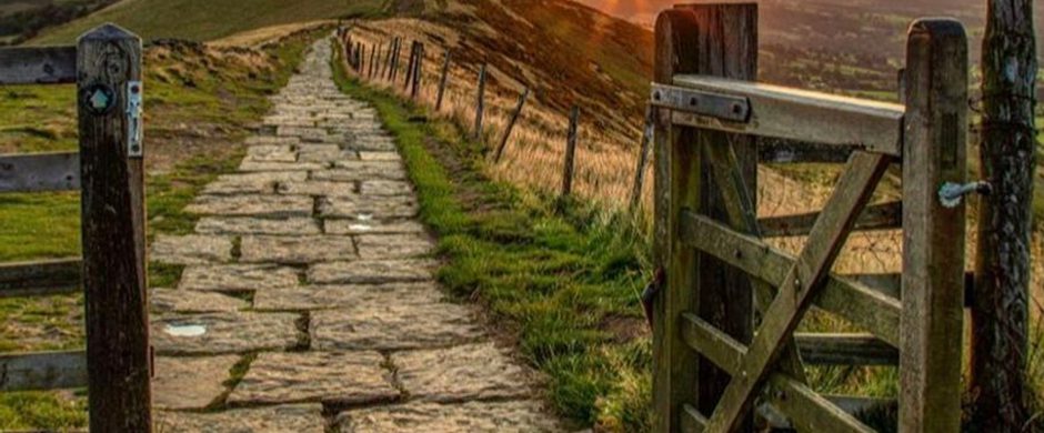
The path eventually reaches a metal kissing gate. Go through the kissing gate and turn immediately right, walking with a fence to your right and a stone wall to your left. The trees quickly clear to your right, giving you wonderful views of Derwent Edge.
After approx 300 metres the path turns left and follows the line of the stone wall uphill towards the summit of Win Hill. When the wall ends, turn right and follow the clear path uphill in a westerly direction to the obvious peak of Win Hill above you.
Take time to rest awhile at the trig point at the top of Win Hill, which is slightly to the right of the path. From here you get an incredible 360 degree panorama of the spectacular landscape, with views of the Upper Derwent Valley, the Hope Valley and the Kinder plateau. Well worth the climb!
To continue the walk, rejoin the path and turn right, heading in the same direction as before, keeping Win Hill on your right and now behind you. Ignore the path that leads off to the left and doubles back beneath Win Hill.
After approx 200 metres go through a wooden kissing gate on your left, following a narrow path heading diagonally right downhill through heather and gorse. The path is rocky and uneven so take care, but there are wonderful views of the Hope Valley in all directions. Follow the path downhill for approx 750 metres, through a series of gates and over fields, to reach Twitchill Farm, visible ahead of you. There are hot/cold drinks and snacks available here at an Honesty Shop.
The path is well signposted from the farmyard through a wide wooden gate beside a stone barn, now converted into holiday accommodation. Follow the wide farm track as it bears right and heads downhill through fields, with the village of Hope ahead of you.
Continue on the track as it bears right through trees at the bottom of the hill and becomes a metalled lane. At a junction of lanes after approx 100 metres, turn left and walk under a railway bridge. Follow this quiet lane through trees for approx 400 metres, crossing over the River Noe.
Where the lane reaches a T-junction with Edale Road, turn left and follow this quiet residential road for approx 300 metres into the centre of the village of Hope.
When you reach the T-junction with Station Road, turn right to find the Travel South Yorkshire Route 272 bus stop directly ahead of you. If you’re travelling by train, turn left on Station Road and walk for approx 700 metres to find the train station signposted on your left.
Sign up to our newsletter
Receive the latest news, special offers, ideas and inspiration straight to your inbox by signing up to the Visit Peak District & Derbyshire e-newsletter.