About
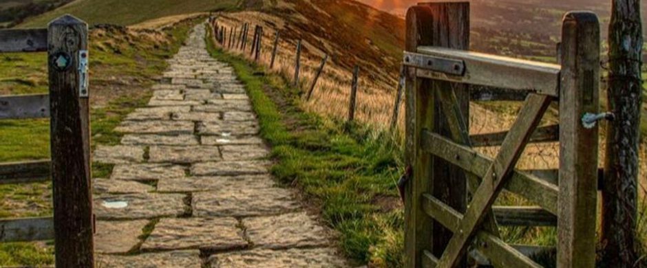
A 155 mile walking route through the stunning Peak District where you can enjoy a walk of contrasts through the Dark Peak & White Peak. Experience some of the best views in the Peak District with a wide range of accommodation available at the end of each stage. You can also walk it in stages and tackle the 13 stages one by one.
Starting in Stockport, just a few miles outside the Peak District National Park, you will immediately find yourself in lovely countryside. You will soon be in the area known as the Dark Peak which is the higher and wilder part of the Peak District characterised by vast areas of rugged heather moorland, populated with dark gritstone. The views of the surrounding landscape are stunning.
The White Peak is known for its gently rolling limestone plateau, divided by limestone dales which are often steep-sided, whilst in other places the dales are shallower. You will find clear limestone rivers and streams and colourful hay meadows nestled between dry stone walls. Then there are the picturesque villages and quaint hamlets. You will find that walking in the White Peak is very different than that of the Dark Peak, but equally stunning for its sheer beauty
This walk will take you through the prettiest of Derbyshire's towns and villages with plenty of places to stop for a bite to eat on route.
For more information visit the website peakwaywalk.com/. You can purchase a detailed guide book to enhance your walk here https://www.peakwaywalk.com/product-page
Trail directions
Starting out from Stockport, you'll immediately find yourself in beautiful countryside which continues all the way to Hayfield. And you'll see lots of amazing heritage features such as Marple viaduct and aqueduct and the Torrs Riverside Park along the way, as your walk soon takes you into the Peak District. You'll see an ancient chapel, historic Goyt Hall Farm and a hydro-electric station and canal boats as you walk along the towpath. This is a picturesque route for your first day of the walk. (14 miles)
This stage includes the ascent and descent of Kinder Scout where you'll reach the highest point on the Peak Way and you'll enjoy magnificent views for much of the time. The walk includes a steep climb up William Clough, then walking on rough moorland paths which include stony paths. The final part of the walk is down via Jacob's Ladder and then through fields to Edale. (10 miles)
This is a relatively short walk and so you might have time to explore the lovely village of Castleton and the Hope Valley at the end of your walk, or even visit one of the nearby caverns. The first part of the walk is through fields, followed by a climb up to the moorland on Rushup Edge. The path along the Great Ridge, via Mam Tor, is clearly defined and the views of the Edale and Hope Valleys are amazing. (9 miles)
This is a long walk and most of the walk is on high moorland and along gritstone edges above the reservoirs. There is a section of level walking alongside Derwent Reservoir before ascending to Derwent Edge where you'll see many interesting rock formations. Then you'll descend before climbing again to Bamford Edge where you'll have superb views of Ladybower Reservoir and beyond. (16 miles)
Most of this walk is on high moorland paths and starts with a trek across Moscar Moor to reach Stanage Edge. On your 4 mile walk along the Edge you'll have stunning views of the surrounding landscape before walking to Higger Tor for more splendid views. Then a path down the beautiful Padley Gorge and through fields will take you to Grindleford. (12 miles)
The route starts in woodland and then along the high-level moorland of Froggatt, Curbar and Baslow Edges with more fabulous views. Then from Baslow you'll walk through the magnificent Chatsworth Estate, and the lovely village of Edensor, before arriving in Bakewell. (9.4 miles)
After ascending through woodland you'll walk through Calton Pastures and then through fields to reach Rowsley. Then you'll continue through more fields and pass through hamlets before reaching your destination of Matlock. (10 miles)
This is a long route with several ascents and descents. Leaving Matlock on the riverside path, you'll soon ascend to enjoy great views. Then there's another ascent above Matlock Bath before coming down to the historic village of Cromford. Walking uphill again to reach the High Peak Trail and Middleton Top, you'll then pass through fields to descend to Carsington. Then it's through fields to Hognaston, through fields to ascend to Madge Hill and finally through fields to Ashbourne.(15.6 miles)
This route is mainly along riverside paths along deep-sided limestone dales and fields. After a short ascent then descent into Mapelton, then through fields, you'll soon reach the iconic Dovedale. Then following the River Dove you'll reach the quaint hamlet of Milldale. Then you'll pass through the beautiful Wolfescote Dale and Beresford Dale before reaching the lovely village of Hartington.(12
Starting from Hartington, you'll soon reach the hamlet of Heathcote before joining the Tissington Trail. Then a short walk on a minor road will take you to the village of Monyash. From here, you'll soon be at the historic Magpie Mine which you can explore for a while, before continuing to reach the lovely village of Sheldon. Then you'll descend through fields to the 'picture postcard' village of Ashford-in-the-Water. (10 miles)
Initially walking through Great Shacklow Wood, you'll soon be walking down the beautiful Monsal Dale to reach the iconic viaduct at the end. Then you'll walk along Monsal Trail, passing the former Millers Dale station, and through the Cressbrook Tunnel before dropping down to the stunning Cheedale where you might want to slow your pace to enjoy this special place. Then there's a steep climb and a descent and ascent in the steep-sided Deepdale, before walking through fields and the hamlets of King Sterndale, Cowdale and Staden to reach Buxton.(14.5 miles)
A short walk from Buxton centre will take to the wilderness of Wild Moor from where the views are stunning. From here you'll walk alongside the Errwood and Fernilee Reservoirs and then follow tracks and paths to the lovely hamlet of Taxal. From here you'll follow paths to pass the damaged dam above Whaley Bridge before descending to the town.(8.6 miles)
Leaving Whaley Bridge on a short road walk, you'll soon reach Whaley Moor from where you'll have great views of the surrounding landscape. Then you'll cross into the estate of the National Trust's Lyme Park where you'll pass close to the magnificent Lyme Hall. The route then follows a canal towpath before crossing a golf course to reach the Middlewood Way (another former railway line). And finally you'll follow the River Goyt back to Stockport where you started. (14 miles)
Sign up to our newsletter
Receive the latest news, special offers, ideas and inspiration straight to your inbox by signing up to the Visit Peak District & Derbyshire e-newsletter.