Prices from
£41
Experiences
Geology Field Days in the Peak District with Lithosphere Expeditions
Explore 350 million years of Earth history on our guided geology days. Learn to read the rocks, discover fossils, & explore the dramatic limestone & gritstone landscapes
About Geology Field Days in the Peak District with Lithosphere Expeditions
Geology Field Day Experience
What You’ll Discover on a Peak District Geology Walk
The Peak District sits at the junction of two dramatically different geological landscapes: the ancient limestone plateau of the White Peak and the younger, wilder gritstone moorlands of the Dark Peak. Our geology field days explore both, giving you a hands-on understanding of how 350 million years of Earth history shaped the landscape you see today.
During a typical geology walk in the Peak District, you’ll learn to read the rocks like a book. We’ll examine coral fossils in limestone walls that formed on a tropical seabed, trace the paths of ancient rivers through layers of gritstone, and visit disused lead mines where centuries of industrial history have exposed geological formations that would otherwise remain hidden underground.
Geology Walk Locations
We run geology walks across the Peak District, choosing locations based on what will give your group the most rewarding experience. Popular geology walk routes include the Castleton area (where limestone meets gritstone at the famous Mam Tor landslip), the Eyam and Stoney Middleton valley (where mineral veins, lead rakes and quarry faces reveal the White Peak’s geological structure), and Lathkill Dale (one of the finest limestone dales in England, with tufa dams, mine workings, and a remarkably clear river).
Who Are Our Geology Field Days For?
Our Peak District geology walks are designed for anyone with curiosity about the natural world, you don’t need a science background. They’re popular with families, walking groups, geology students and amateur rock enthusiasts. We also run sessions tailored for GCSE and A-level geography students, university field trips, and special interest groups. Every field day is adapted to your group’s level of knowledge and physical ability.
Three Periods of Peak District Geology
The Peak District’s rocks record a 350-million-year sequence that begins on a tropical seabed near the equator and ends on the high moorland plateaux of central England. A Peak District geology walk traces this story through three main intervals.
Carboniferous Limestone (around 340 to 326 million years ago)
Millstone Grit (around 326 to 318 million years ago)
Coal Measures and after (around 318 million years ago to today)
Where We Run Peak District Geology Walks
We choose the route for each Peak District geology walk to match what your group wants to see. The four areas below are our most-used.
Castleton: Limestone, Caves and the Mam Tor Landslip
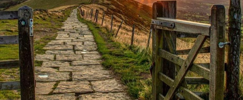
Castleton geology walks combine surface and underground in a single day. The Castleton area sits at the rare junction where the Carboniferous limestone of the White Peak meets the Millstone Grit and Edale Shales of the Dark Peak, with all three exposed within a one-mile walk. Mam Tor itself is a working textbook example of slope failure, a mass of unstable Edale Shale capped by a thin gritstone layer that has been actively slumping for at least 4,000 years. Cave Dale gives you a dry limestone gorge with a fault running down its floor. Speedwell Cavern and the Devil’s Arse let you descend into the cave systems formed by water working along the limestone joints.
Eyam and Stoney Middleton: Mineral Veins and Lead Mining Heritage
The Eyam and Stoney Middleton area is the best place in the Peak District to read the link between geology and human history. The mineral veins that thread the limestone here, lead, fluorite, calcite and barite, were the basis of an industry that ran from the Roman period through to the twentieth century. Geology walks in this area visit working-face quarry exposures, follow the line of named lead rakes (the Eyam, the Hucklow Edge), and descend into preserved mine shafts at Watergrove and Magpie Mine. Carlswark Cavern beneath Stoney Middleton gives an underground option, and the Cliff above the village shows fossil coral reefs at exactly the level where ancient shoreline and reef-front sediments are preserved together.
Lathkill Dale: One of England’s Finest Limestone Dales
Lathkill Dale geology walks follow one of the most complete limestone dale sequences in England, from the headwaters of the river through tufa dams (where dissolved limestone has redeposited as freshwater carbonate around plant material), past the remains of nineteenth-century lead mine workings at Bateman’s House and Mandale Mine, to the lower dale where the river goes underground in dry summers. The dale walls expose massive limestone beds with clear bedding, joint sets and the fossil debris of an ancient reef.
The Eastern Edges: Gritstone Geology Walks
Geology walks along Stanage, Froggatt, Curbar and Burbage Edges look at the Millstone Grit story directly. The cliff faces show metres-thick beds of coarse sandstone with cross-bedding picked out by weathering, occasional siltstone partings recording quieter periods between flood events, and the millstones quarried from these edges in the eighteenth and nineteenth centuries that gave the rock its name. From the top of the edges you look west across the Hope Valley to the limestone country and can read the entire stratigraphic relationship in one view.
What You Will Learn on a Peak District Geology Walk
A typical Peak District geology walk gives you the practical skills to read the landscape independently after the day is over.
- How to identify the major Peak District rock types in the field: Carboniferous limestone, Millstone Grit sandstone, Edale Shale, Coal Measures sandstone
- How to read sedimentary structures, bedding, cross-bedding, ripple marks, that record the environment in which a rock formed
- How to find and identify common Peak District fossils: brachiopods, crinoid stems, corals, occasional goniatites
- How mineral veins formed and why they followed particular lines of weakness through the limestone
- How glacial and post-glacial processes shaped the dales, the gritstone tors and the moorland plateaux you walk across
- How to use a basic geological map and relate the colours on it to what you see in the landscape
Best Time of Year for a Peak District Geology Walk
Peak District geology walks run year-round. Each season offers something different. Late spring and early summer give the longest daylight and the warmest underground sessions, with mineral colours showing best in dry conditions. Autumn light brings out the cross-bedding and joint patterns on the gritstone edges most clearly, and the dales are at their most dramatic with low sun and falling leaves. Winter walks have their own appeal: with vegetation cleared back you can see further into quarry faces and dale walls, and underground sessions are noticeably warmer than the surface. We adapt the route to the conditions on the day.
A £100 deposit secures your date. Half-day trips start at 9am or 1:30pm; full-day trips start at 9am. Other start times can sometimes be arranged, but please email us first if you need something different, before booking. Tell us which activity you would like and how many people are in your group. We will confirm your total price for your activity and group size, then send a link for the remaining balance closer to the time.
https://lithosphere-expeditions.co.uk/geology-field-day-experience/
Location
Various location in the Peak District National Park, Derbyshire, England, United Kingdom
- Phone:
- +44 7410 237429
Submit an event
Do you organise an event in the Peak District and Derbyshire? If so, please submit the details of your event here for the chance to see it published on our What's On page free of charge.

Sign up to our newsletter
Receive the latest news, special offers, ideas and inspiration straight to your inbox by signing up to the Visit Peak District & Derbyshire e-newsletter.