Trails
Glossop Circular Route
Glossop Circular Walk is a 21 kilometre (13 miles or 30,000 steps) circular walk around Glossop using bridleways, public footpaths, tracks and quite country lanes.
About
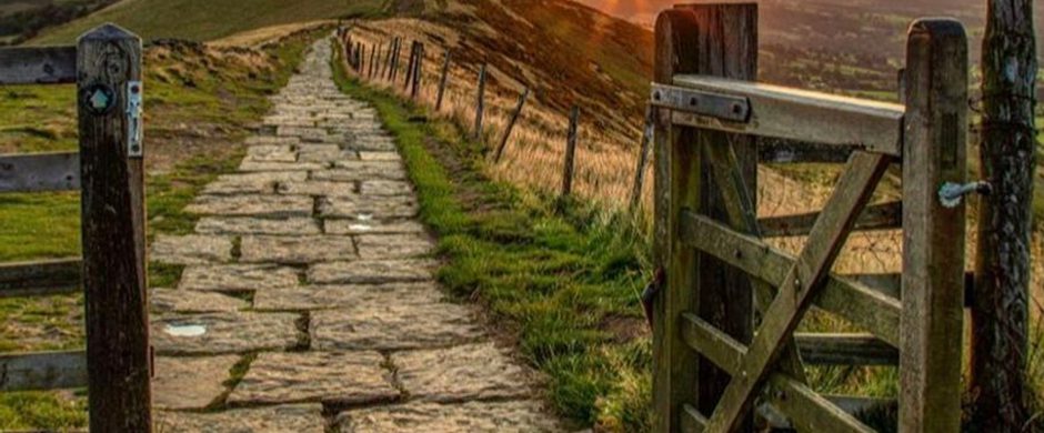
This lovely walk roughly follows the boundary of the Peak District National Park and encompasses stunning views, open moorland, gorse heathland, wet woodland, quite country lanes, industrial heritage, brooks, rivers, reservoirs, pine forests plantations and the occasional watering hole!
Walk courtesy of Move More Glossop. Find more walks around Glossop the-bureau.org.uk/services/move-more/
Respect, Protect, Enjoy Whether you're a regular or brand new visitor, we want to make your trip to the Peak District & Derbyshire as safe, easy and enjoyable as possible. Ensure your visit is a responsible one by following the Countryside Code and stay #PeakDistrictProud by keeping dogs on a short lead, parking only in designated areas, sticking to public rights of way where you can, saying no to BBQs and open fires, and taking your litter home with you.
Trail directions
Opposite Allmans Heath Cottages follow the public footpath east towards Swineshaw Reservoir, following the dry-stone wall, the reservoir is enclosed by another dry-stone wall, follow the wall (south-east or anti-clockwise) around the reservoir.
From the over-flow where the reservoir comes to a point, follow the path down through a small woodland, cross over the stream and turn right onto Blackshaw Clough. Follow Blackshaw Clough until it meets Bute Street.
Walk along Bute Street roughly south-west, turning left when you reach Blachshaw Road, walk down Blackshaw Road for only 22m, turning right onto Dunne Road (a narrow road closed to vehicles), this brings you out onto Well Gate with the Wheatsheaf on your left and the Bulls Head on your right (take your pick!) Travel down Church Street past the old cross and left at the Queens Arms onto Shepley Street. Follow Shepley Street all the way to the end past the turning circle for the buses.
Walk along Shepley Street for about 140m heading east, until you reach the footbridge across the brook, heading south up the steep hill, which rises about 35m and then through woodland There are many paths through the woodland, head roughly south and you will come out onto Pyegrove. Walk along Pyegrove for only 155m turning left onto Sheffield Road, Hurst Road is 22m across the road on the right, opposite the Royal Oak.
Walk along Hurst Road, past Glossop & District Golf Club and onto Derbyshire Level. Continue walking along Derbyshire Level for 1.12 km until you reach Kidd Road, turn right into Kidd Road.
Walking west along Kidd Road for about one kilometre and then a sharp left turn at the bench enclosed in a tiny walled garden. Follow the lane all the way to the end where there is a gate, after the gate bear right down the footpath to the stream, keeping the stream on your left follow the path round until you come out onto Chunal Lane next to Moorfield Industries. Turn right onto Chunal Lane.
Walk along Charlestown Road for about 130m, opposite Casa D’Italia is a footpath up some stone steps through the trees, turn left onto the country lane and follow this lane for 500m until you reach a sharp left turn with a footpath sign on the right pointing to Whitley Nab. Follow this path roughly north-west, over two stiles and up to a plantation of fir trees at the top of Whitley Nab. Follow the path around the fir trees keeping them on your right.
Continue on the track past with the plantation of fir trees on your right-hand side walking north west towards the gate, the track continues for 175m towards another gate. Don’t go through the gate but follow the path through the gorse and small trees until you reach a stile over a stone wall. Walk due north (you should be able to see the TV transmitter in the distance), down the hill diagonally across the field until you reach the kissing gate and the stile at the bottom. Cross over the stile onto Old Land and turn left. Walk east along Old Lane in Simmondley passing several Grade II listed houses. At the end of Old Lane is the Hare & Hounds Public House. If you’re not frequenting the pub, there is a shortcut down the steps onto High Lane.
From the Hare & Hounds walk down the hill on High Lane towards Simmondley Lane. Take the second road on the left, Green Lane. Walk along Green Lane until the end where the road turns into a wide track.
Follow the track / bridleway towards Gamesley Sidings, a 28 acre wildlife site made up of wet woodland forming part of the Pennine Bridleway and the Trans Pennine Trail. You might be able to see railway line from Manchester to Glossop & Hadfield on your right-hand side, through the trees, continue on the bridleway and pass under the brick arches of Glossop Road, the trail then splits in two, either way is fine, at the gate at the end of the trail turn right, after 75m turn left at the gate and zig-zag down the path to Long Lane and the River Etherow.
Don’t cross over the road bridge but walk on the smaller road alongside the River Etherow, turning right just before the new house at the footpath sign, then travel east along the path and then track towards Glossop Road, turn left onto Glossop Road and right following the Trans Pennine Trail sign and then left onto Melandra Castle Road. Follow the road all the way round to the remains of the Melandra Roman Fort settlement.
From Melandra Castle Road car park walk a quarter of the way around the ruins and head towards a bollard in the trees, follow the path through the trees and onto the NCN62 turning left heading north-west, continue on the NCN62 over Melandra Road and over the footbridge, heading north-east towards Brookfield and Woolley Lane.
Continue to follow the Trans Pennine Trail / NCN62, crossing over Woolley Bridge Road and follow the footpath back towards the River Etherow. From the River Etherow near Graphite Way, continue to follow the path by the river for a short distance until you reach a footbridge across the river, cross over the bridge and stay on the straight path for 60m where you see some makeshift stepping stones over a stream. After crossing the stream, turn right and follow the path along the river. Stay on the main path and turn right when you get to wider path near the school (green fence), follow this path east until you reach New Road, turn right on New Road and just before the traffic lights turn left into Bank Lane. Take the footpath on the right, down the steps and you’ll reach Bottoms Reservoir.
Walk along the footpath by the edge of Bottoms Reservoir for about 1km then make a left turn at the gate signposted toward the Trans Pennine Trail (TPT). Walk diagonally and up through field until you find the subway under the Longdendale Trail. From the subway under the Longdendale Trail head south-east over the stile and up the hill through the field to another stile onto a track. Turn left and follow the track all the way to Padfield. The track brings you out onto Padfield Main Road, (turn right for the Peel Arms pub) or turn left and head up the road turn right at Peel Street. Follow the path and about four stiles, the path eventually brings you out onto Little Padfield Road, turn left in to Little Padfield.
Follow the road through Little Padfield to a footpath on your right, through the gate and into the field. Follow the wall on your right, over the stone stile to the footpath sign. Follow the route to Allman's Heath & Swineshaw over the stile and small stream. Follow the path up the hill towards Glossop Cemetery. Follow the cemetery wall to a small derelict building and then through a stonemason's yard to The Byre cottage and onto Woodhead Road. Turn left onto Woodhead Road.
Sign up to our newsletter
Receive the latest news, special offers, ideas and inspiration straight to your inbox by signing up to the Visit Peak District & Derbyshire e-newsletter.