Trails
Hayfield to New Mills
This lovely 13 km (8.1 miles) walk starts and ends at the bus station in the historic village of Hayfield, following the Sett Valley Trail into the picturesque town of New Mills.
About
This lovely 13 km (8.1 miles) walk starts and ends at the bus station in the historic village of Hayfield, following the Sett Valley Trail into the picturesque town of New Mills. Explore the industrial heritage and natural beauty of The Torrs, a sandstone gorge where the River Sett meets the River Goyt, and admire the views of the mill buildings from the curving Millennium Walkway. The route then takes you out on field trails and quiet lanes through wonderful open countryside before returning to Hayfield.
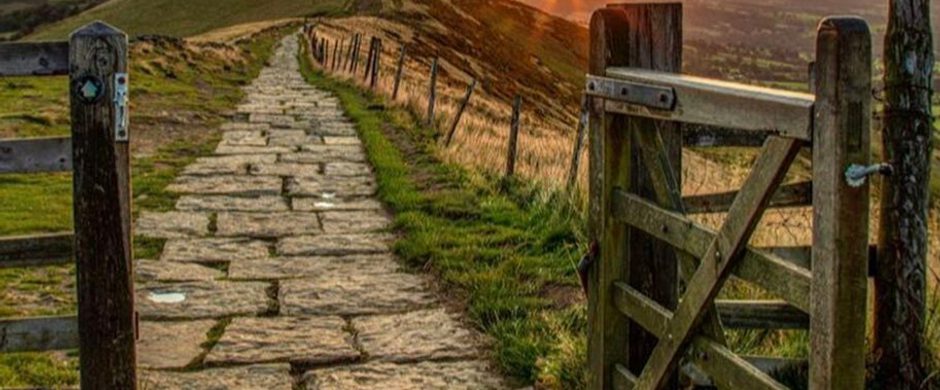
Please note that the trail passes through a number of gates and crosses two roads on the way.
Start and end point: The bus station in Hayfield 53.37915893943429, -1.9473076630545016 (SK22 2ES; ///drops.obliging.layers)
Hayfield is served by the High Peak 61 service. For more travel information visit travelderbyshire.co.uk
Respect, Protect, Enjoy Whether you're a regular or brand new visitor, we want to make your trip to the Peak District & Derbyshire as safe, easy and enjoyable as possible. Ensure your visit is a responsible one by following the Countryside Code and stay #PeakDistrictProud by keeping dogs on a short lead, parking only in designated areas, sticking to public rights of way where you can, saying no to BBQs and open fires, and taking your litter home with you.
Written and produced exclusively for Visit Peak District & Derbyshire by Peaklass. Find out more at www.peaklass.com.
Trail directions
The walk starts at the bus station in Hayfield (SK22 2ES; ///drops.obliging.layers). Walk just beyond the public toilet block to join the well-marked Sett Valley Trail and turn right, signposted to New Mills.
The Sett Valley Trail follows the route of the former single-track railway branch line from New Mills to Hayfield, opened in 1868 and closed in 1970. It is now a peaceful, traffic-free route through beautiful countryside for walkers, cyclists, riders and wheelchair users.
Continue following the Sett Valley Trail, ignoring all footpaths off, for approx 4km, until you reach St George’s Road at the edge of New Mills. The route is well signposted all the way. Please note that the trail passes through a number of gates and crosses two roads on the way.
When you reach the end of the bridleway at the edge of New Mills, cross over St George’s Road and follow the footpath directly opposite. The path zigzags down through trees and soon reaches another road, Church Lane. Turn left briefly on Church Lane and then quickly right again after approx 100 metres to continue on the footpath.
Cross under a bridge, following the signs to The Torrs, and stay on the lower footpath. After approx 50 metres, take the footpath off to the left, signposted to The Torrs Riverside Park down a set of steps to the river.
Follow the path beneath a road bridge and over a wooden footbridge. At a fork in the path stay to the right, crossing the river again and entering The Torrs, once the site of a cotton mill, Torr Mill, built at the end of the 1700s. The impressive weir is not only beautiful, it powers the Torrs Hydro, the UK’s first community owned and funded hydro electricity scheme.
From The Torrs, follow the signs to the Millennium Walkway, passing beneath a towering viaduct. Follow the curving structure of the Millennium Walkway with impressive views over the River Goyt towards Torr Vale Mill.
At the end of the Millennium Walkway, continue straight on for approx 50 metres and then cross over a metal bridge on the left. Follow the narrow, winding path up a set of steps towards Torr Vale Mill. At the top of the steps, turn right onto a driveway that eventually becomes Torr Vale Road.
At the top of the short hill, follow the road as it bears round to the left. Continue straight on across a junction and walk along Jodrell Street for approx 150 metres, to meet the A6015 (Albion Road). Turn left on Albion Road.
Continue walking along Albion Road for approx 200 metres, crossing a bridge over the river with views across to the mill on your left. Carefully cross the road after the bridge and take a footpath on the right just after a bus stop.
Follow the track gently downhill through trees to meet up with the River Goyt on your right, passing underneath a viaduct with a railway above. Continue straight on the track, ignoring all footpaths off, passing farms and emerging into open countryside.
At a group of gates, the track continues through the wooden gate on the right, after which it narrows to a path through trees and fields. After a further 500 metres, the track emerges at a gate onto a road, Marsh Lane. Turn right on to Marsh Lane and then almost immediately left on to Ladypit Road. Please note that there is no pavement here so take extra care, but the road is usually quiet and is relatively wide. Follow Ladypit Road for approx 500 metres.
Where the road bears sharply right just beyond a house on the left, take the Public Bridleway clearly signposted on the left. After approx 100 metres the track forks; follow the left hand fork. Stay on this Bridleway for approx 1 km, passing through beautiful countryside, ignoring all footpaths off.
The Bridleway eventually reaches a T-junction with a metalled farm track. Turn right on the farm track for approx 50 metres, and then right again onto Laneside Road.
Follow Laneside Road through open countryside for approx 600 metres. Ignore the first crossroads of paths at Shedyard Farm, and continue on until the road ends at a crossroads with a Restricted Byway, known as Over Hill Road.
Turn left on Over Hill Road and follow this track for approx 2 km, passing farms and enjoying great views of the surrounding moors and hills. Ignore all footpaths off.
Over Hill Road eventually becomes a tarmacked road and descends downhill into the village of Birch Vale, emerging onto Hayfield Road. Turn right on Hayfield Road.
After approx 250 metres, at a junction with Station Road, look out for a public footpath on the left leading downhill between houses to return to the Sett Valley Trail.
Turn right on the Sett Valley Trail and follow the quiet track for approx 1.2 km, eventually returning to your start point at the bus station in Hayfield.
Sign up to our newsletter
Receive the latest news, special offers, ideas and inspiration straight to your inbox by signing up to the Visit Peak District & Derbyshire e-newsletter.