Trails
Renishaw to Eckington Circular
This lovely 8 km (5 miles) walk takes you away from the bustle of traffic and out into the deepest, most peaceful countryside - within only a few hundred metres.
About
This lovely 8 km (5 miles) walk takes you away from the bustle of traffic and out into the deepest, most peaceful countryside - within only a few hundred metres. The route follows the Trans-Pennine Trail and then heads out on field paths beside the River Rother as it flows through quiet meadows. The town of Eckington is at the halfway point, with shops and pubs if you need a break for refreshments. The walk then continues through beautiful open parkland and fields before returning to the Trans-Pennine Trail and your starting point.
Start/Finish Point: This route starts and ends on Main Road, Renishaw (S21 3WT; ///accompany.soldiers.dolphins), which is served by the Stagecoach 80 bus service.
Respect, Protect, Enjoy Whether you're a regular or brand new visitor, we want to make your trip to the Peak District & Derbyshire as safe, easy and enjoyable as possible. Ensure your visit is a responsible one by following the Countryside Code and stay #PeakDistrictProud by keeping dogs on a short lead, parking only in designated areas, sticking to public rights of way where you can, saying no to BBQs and open fires, and taking your litter home with you.
Written and produced exclusively for Visit Peak District & Derbyshire by Peaklass. Find out more at www.peaklass.com.
Trail directions
From any of the Stagecoach 80 bus stops on Main Road in Renishaw, walk in a north-westerly direction (towards Eckington) along Main Road away from the town.
As you walk over a bridge with metal railings, take the public footpath on your right down a set of steps. At the bottom of the steps turn left to reach the Trans-Pennine Trail directly ahead of you. Turn right on the Trail, signposted to Sheffield.
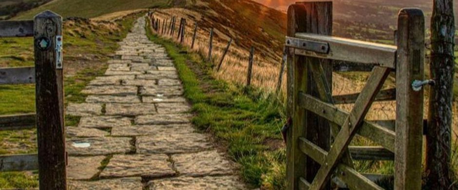
The Trans-Pennine Trail is a long distance path, established in 2001, that stretches coast to coast from Southport in Merseyside to Hornsea in East Yorkshire. It’s 346 km (215 miles) long.
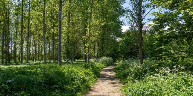
Follow the Trail, ignoring all paths off, for approx 3 km (1.8 miles). The route takes you beneath shady trees with views of the wonderful surrounding countryside.
When you reach Killamarsh Station, take the footpath to the left, signposted towards Killamarsh Greenway. Follow the path slightly uphill for a short distance to reach a T-junction of paths, and turn left on the public footpath.
Stay on the path as it bears right, following the line of steel fencing. After approx 100 metres, go through a gate and follow the well-marked footpath to the left. This path soon meets the River Rother and twists through fields for approx. 1 km.
When you see a railway bridge over the river ahead of you, continue following the path as it bears right and passes underneath one arch of the bridge.
Continue straight on through a beautiful wooded area, with tall trees to your left and the river to your right. Stay on the main path, ignoring paths off into the trees.
After approx 300 metres, cross a footbridge over the river. The path forks immediately after the bridge; take the left hand fork and after a very short distance you will emerge through trees onto a narrow lane (Pipworth Lane). Carry roughly straight on along the lane.
Follow Pipworth Lane for approx 400 metres until you reach a T-junction with Rotherham Road in Eckington. If you need refreshments, there are a number of pubs and shops in the town ahead of you.
Continuing the walk, turn left on Rotherham Road. Stay on the left, keeping to the pavement, and follow the road as it bears left and becomes Littlemoor. There are lovely views across parkland to the left.
Follow Littlemoor for approx. 500 metres, and then bear left again around the corner. Almost opposite the road leading to Staveley, which goes off to the right, look out for a public footpath on your left.
Follow this footpath with a fence to your right and trees to your left until it emerges into beautiful open parkland after approx 200 metres, part of Renishaw Park Golf Course. Keep following the path straight ahead. At a small fork in the path as you enter a wooded area, take the right hand fork.
Continue straight on for approx 400 metres and cross a metal footbridge over the River Rother. After crossing the bridge, although the stile takes you off to the right, continue straight ahead towards a wide metal gate with a stile beside.
Go over the stile or through the gate and continue straight on, following a wide track for approx. 600 metres between hedges, over a railway bridge, and to the side of a farm, surrounded by countryside. Ignore all paths off.
When you reach a pair of squeeze stiles just beyond the farm, go through the stile on the right, turn immediately right and take the narrow path through trees. This path eventually leads downhill to reach the Trans-Pennine Trail again. Turn right when you reach the Trail.
Follow the Trail for approx. 1.5 km, until you reach the road bridge over the Trail. Immediately before the bridge, turn left and take the set of steps up to reach Main Road in Renishaw and the start of your walk. Turn left on the road to return to the town.
Sign up to our newsletter
Receive the latest news, special offers, ideas and inspiration straight to your inbox by signing up to the Visit Peak District & Derbyshire e-newsletter.