Trails
Castleton Heritage & History Walk
This lovely 5.4 mile route takes you around the highlights of Castleton, one of the prettiest and most historically significant villages in the Peak District, surrounded in all directions by wonderful views.
About
The walk starts with an easy stroll around the village itself and then heads out into the open countryside to take in Hollins Cross, the Great Ridge, the summit of Mam Tor (517m), the ‘Broken Road’ and Odin Mine, passing all four show caverns along the way. Please note that there are some relatively steep ascents and descents, with uneven terrain. There are gates and a number of steps, but no stiles. Castleton has public toilets and a wide range of cafes and pubs for refreshments before or after the walk.
Start / Finish Point
The Car Park at Castleton Visitor Information Centre (S33 8WN; ///chilled.campsites.keyboards).
Respect, Protect, Enjoy Whether you're a regular or brand new visitor, we want to make your trip to the Peak District & Derbyshire as safe, easy and enjoyable as possible. Ensure your visit is a responsible one by following the Countryside Code and stay #PeakDistrictProud by keeping dogs on a short lead, parking only in designated areas, sticking to public rights of way where you can, saying no to BBQs and open fires, and taking your litter home with you.
Written and produced exclusively for Visit Peak District & Derbyshire by Peaklass. Find out more at peaklass.com.
Trail directions
Walk in a southerly direction out of the car park, passing the Visitor Information Centre on your right. When you reach the road, turn left onto Cross Street and follow the signs to Peveril Castle.
Look out on your left here for the Town Ditch Fields, the remains of Castleton’s defences in medieval times.
Cross the road with care and take the road on your right immediately beyond The Castle pub, Castle Street. Walk along Castle Street, with Peveril Castle visible high above you on the hill straight ahead.
Peveril Castle is one of England's earliest surviving castles; its Keep was built for King Henry II in 1176. Although largely ruined, it is fascinating to explore and offers wonderful views if you have time to visit.
Castle Street opens out into the old market place, which has been used as a gathering and trading area since the 13th Century. Take your time to explore the many historic buildings here.
On your right as you near the end of the street is Castleton Hall, a grand building with a baroque façade, dating from the early 1700s.
Turn left towards the triangular village green with its Celtic war memorial cross, and then turn left again to walk out of the market place on Back Street.
Look out on your left for the church of St Edmund’s, which dates back to the 12th Century.
Back Street soon meets up with the main road through Castleton, emerging next to Ye Old Nag’s Head pub. Walk straight on, passing the pretty village primary school on your right, which dates from 1863. Where the road bends sharply right opposite the Post Office, cross with care and continue walking straight on along Millbridge.
This road was once the ancient packhorse route over the hills to Edale.
You can take a short cut back to the start of your walk here if you don’t want to complete the full route. Just take the footpath on your left after approx 180 metres, immediately beyond the Rambler’s Rest coffee shop, which returns you directly to the car park.
To continue with the walk, carry straight on along Millbridge. Take care because there is no pavement but the lane is usually quiet. After approx 400 metres you will reach a fork in the road. Take the left hand fork.
Walk for a further 200 metres until you reach another obvious fork in the road. Again, take the left hand fork. The lane narrows and twists out into open countryside, with the Great Ridge visible ahead of you.
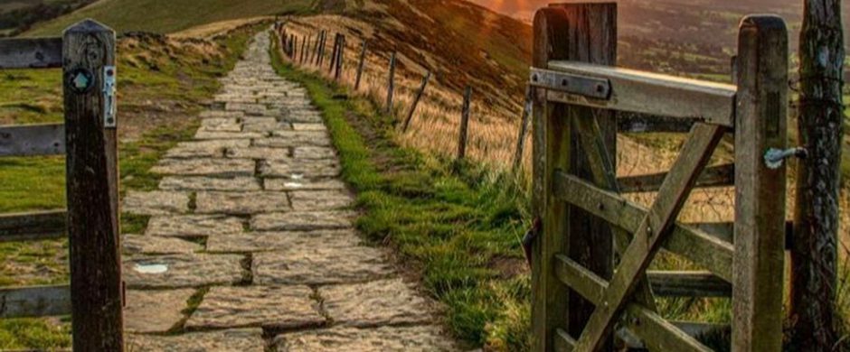
After approx 650 metres, where the lane curves sharply to the left, continue straight on following the stony bridleway through a gate, signposted to Hollins Cross. Take the time to read the information board here about the ancient fields in this part of the Hope Valley. Follow the bridleway gently uphill between trees to reach a further gate.
Immediately after going through the second gate, turn left and follow the clear public footpath signposted to Hollins Cross. This path winds uphill through the bracken and grasses and offers beautiful views over the Hope Valley. Take care because it is steep and stony in parts.
When you reach the very top of the hill, go through the gate to emerge onto the Great Ridge at the round stone summit point of Hollins Cross.
This crossroads of paths marks a resting point on the ‘Coffin Road’ from Edale to Castleton, along which the villagers carried their dead before Edale had its own church.
Turn left on the wide, clear, paved footpath and continue winding gently uphill for approx 1.3km until you reach the trig point at the summit of Mam Tor, with the Hope Valley on your left and the Edale Valley on your right.
Pause awhile when you reach the trig point at Mam Tor (517m).
Mam Tor is not just an iconic peak in this area, it’s also a site of human occupation from around 1200BCE and one of the earliest and largest Bronze Age hill forts in Britain.
Mam Tor business record
Continuing the walk, stay on the same paved path and follow the steps as they curve left and down towards a gate beside a road. Go through the gate and then turn immediately left, following a paved path down beside a fence, following the sign to Winnats Pass and Castleton. Go through a further gate and turn immediately left again, walking across a grass field. The path meanders and isn’t always clear, but keep roughly following the fence line on your left.
At the bottom of the field go through a gate and turn left on the quiet road. After approx 275 metres keep an eye out for the entrance to Blue John Cavern on your right.
Blue John Cavern is one of only two caverns in the world where you can see the rare blue/purple and yellow mineral, Blue John, in its natural state. The other cavern is Treak Cliff Cavern, which you will pass later in the walk. Both are open to the public and well worth a visit if you have time.
When the tarmacked surface of the road runs out, go straight on through a gate and follow the ‘Broken Road’ that curves below Mam Tor.
Once the A625 used regularly by local traffic, the unstable shale geology of this road led to regular land slippages, causing the council to finally abandon its upkeep in 1979.
Continue walking along the Broken Road, ignoring all footpaths off, taking care where the surface is uneven. After approx 600 metres the road bears right and doubles back on itself in a hairpin bend. There are wonderful open views across the Hope Valley on your left.
Soon after passing through a wide metal gate, look out on your right for Odin Mine, one of the oldest lead mines in the UK, in use from around 1280 until its closure in 1847. Very soon afterwards, look out on your left for signs to the Crushing Circle, dating from 1823. It is well worth the short diversion to look at.
The Crushing Circle was once used to crush lead ore from Odin Mine and the surrounding area, and its original stone wheel with steel circular track is still intact.
Retrace your steps to continue with the route and carry on walking along the peaceful lane, passing Treak Cliff Cavern on your right. Soon after the road bears left, look out on your right for a footpath signposted to Speedwell Cavern. Follow this footpath through a gap in the stone wall and across the grass field, heading diagonally right towards the prominent white building.
The footpath emerges at a gate to the left of Speedwell Cavern. Speedwell Cavern is another former lead mine, used until 1771. It is open to visitors who can explore its tunnels and caves by boat. Cross over the road with care and take the footpath through a wooden gate opposite, past the National Trust sign for Longcliff.
Follow the clear path to the right of the stone wall, with views of Castleton to your left. Where the path forks after approx 500 metres, with the right hand fork heading sharply uphill, take the left hand fork and stay on the lower path, still following the line of the stone wall all the way back to Castleton.
Go through a metal gate and head down into the village. The stone track soon becomes a quiet road with houses on both sides. After approx 100 metres look out for a footpath sign on your right.
If you have time, take a short diversion along this path to look at the impressive entrance to Peak Cavern, the largest cave entrance in Britain. Peak Cavern is now open to the public but until 1915 it was home to some of Britain’s last Troglodytes, who lived in houses built inside the cave mouth and made a living selling rope.
Continuing with the walk, retrace your steps and carry on walking down the hill into Castleton village. You will cross the bridge over Peakshole Water, which rises in Peak Cavern. The stream once powered a corn mill in Castleton which remained in use until the 1920s. Very soon after the bridge on your left hand side, take the public footpath which leads beside the stream. The path brings you out directly opposite the car park and the start of your walk.
Sign up to our newsletter
Receive the latest news, special offers, ideas and inspiration straight to your inbox by signing up to the Visit Peak District & Derbyshire e-newsletter.