Trails
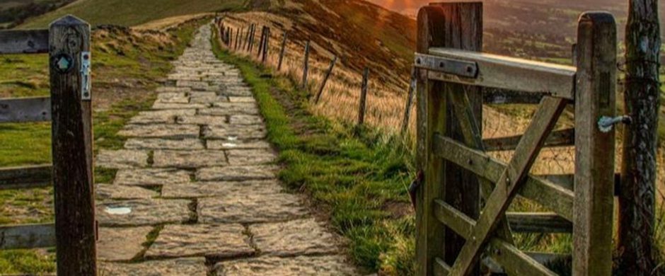
The White Peak Loop
An incredible circular route of just over 42 miles that runs through the most beautiful areas of Derbyshire & the Peak District.
About
The White Peak Loop is an incredible route of just over 42 miles through stunning and diverse scenery, the White Peak loop is set to make Derbyshire one of the UK's most cycle-friendly destinations. Whether on foot, bike or horse, for work or recreation, this will be a journey through the history, culture, countryside and communities of Derbyshire. Offering an outstanding visitor experience where you can really feel alive and return home refreshed, inspired and with memories to treasure for a lifetime.
The entire loop can be cycled in 2 to 3 days so ideal for a bikepacking adventure, or walkers could take 2 to 4 days to complete with ample accommodation available on route to create a great short break walking challenge.
Journey along former railway lines and the Pennine Bridleway National Trail taking in the scenery of the White Peak and Derwent Valley Mills World Heritage Site with refreshments, picnic, accommodation and cycle hire opportunities. The current route is around 42-miles long with 2,000ft climb: 5 miles on-road, 36 miles off-road, I mile pushing (hike-a-bike).
These are suggested itineraries to cycle the entire loop in 2 or 3 days, or walking intineraries over 2, 3 or 4 days -you can download the GPX file for reference. The trail is signed White Peak Loop, we recommend that you plan your route ahead and take the weather forecast into account.
You can find a more detailed map online at cycle.travel - the route will be marked with blue 'White Peak Loop' signage. Got more questions ? Check out our FAQs - they should answer any other queries you may have.
Respect Protect Enjoy
Ensure your visit is a responsible one by following the Countryside Code and stay PeakDistrictProud by parking only in designated areas and taking your litter home with you. Always be safe and responsible when out on your bike.
Trail directions
Start in Matlock, Matlock is easily accessed by bus or rail and the are plenty of bike friendly places to stay. Matlock boasts pretty streets full of independent shops, and a host of cafés, pubs and restaurants in which to relax.
- From Matlock Rail station exit the car park and turn left on the shared-use path alongside Derwent Way follow NCN 680 and cross Cawdor Way at the signal-controlled crossing.
- At the roundabout, take the first exit towards Buxton and Manchester (A6), staying on the cycle route.
- After approximately 600m, just beyond the Welcome to Darley Dale sign, turn left across the heritage railway and then right to follow White Peak Loop (WPL) towards Darley Dale and Rowsley.
The trail takes you through the Haddon estate, with far reaching views of the surrounding countryside. Over 900 years old, Haddon Hall is one of the country’s most elegant, historically important, and timeless stately homes. Soon you reach the bottom of the Monsal Trail where there is a short push up to join the trail. Follow the trail and explore the delights of the only town within the boundaries of the Peak District National Park carry straight on along Coombs Road into the heart of Bakewell, a pretty market town perhaps best known for its unique and delicious Pudding, but it has many other tempting treats to offer. Rejoin the Monsal Trail and don’t forget your camera as you’ll want to take some pictures of the stunning views of the valley across the River Wye from Monsal Head Viaduct.
Continue to Millers Dale, a exceptionally beautiful section of the River Wye. Continue to the end of the trail at Blackwell Mill where you will connect to the Pennine Bridleway National Trail across to the A515 Ashbourne Road at Dowlow. Here you can join the High Peak Trail and head south towards Parsley Hay, here you’ll find the Peak National Park Cycle Centre. Keep left when the trail forks and follow the High Peak Trail. Enjoy delightful views of the surrounding countryside from Middleton Top. The site has a gift shop, cycle hire, toilets and picnic area. The Middleton Top Engine House is open to the public on certain weekends throughout the year. A short detour of the route near here is the historic market town of Wirksworth.
Continue along the trail to High Peak Junction and then join the narrow towpath that runs alongside the Cromford Canal. The nearby village of Cromford, is forever associated with Sir Richard Arkwright as the birthplace of the Industrial Revolution and forms part of the Derwent Valley Mills World Heritage Site. At Cromford Wharf cross over into Cromford Mills (link) which offers guided tours, a visitor centre with shops and a café. Rejoin the route through The Mills car park and along Church Walk to join the Derby Road (A6) for a short while passing Masson Mills, until you reach Matlock Bath. Matlock Bath has a long street lined with quirky shops, cafés, amusement arcades and fabulous fish & chips restaurants. Continue through Matlock Bath towards Matlock. Take the riverside path on the edge of Matlock, at Pic Tor and follow the riverside that runs through Hall Leys Park into Matlock town centre or take the cycle route across the bridge to Matlock Railway station.

.

Along The Route

Business
1 Coach House Mews Matlock Bath
From £150 [1 night] *book direct only on 07738 428539. Stylish 2 bedroom ground floor apartment with parking set in an attractive stone conversion…

Featured
Business
Ashford Mill
Ashford Mill is an award winning watermill on the River Wye at Ashford in the Water. A Grade 2 listed 3 bedroomed historic conversion. incredibly…

Business
Bakewell Camping and Caravanning Club Site
The Peak District National Park is waiting to be explored from our Club Site at Bakewell, which is perfect for those wanting to escape the crowds.…

Business
Barn Cottage - Bakewell
A delightful detached barn conversion that is full of charm and character, a perfect holiday destination for a discerning couple. The cottage is…
Frequently asked questions
- Where can I find a White Peak Loop route map?
You can download the GPX file and there’s a link through to a more detailed map here: The White Peak Loop | Visit Peak District & Derbyshire
You can also see the outline of the route on the Cycle Derbyshire map: Cycling - Derbyshire County Council and it’s on the Derbyshire Mapping Portal under the cycle networks tab as White Peak Loop interim.
You can also pick up a copy of the Cycle Derbyshire Map from selected businesses and all libraries across Derbyshire. This is a map showing all the trails in Derbyshire. It will help you plan your journey and connect the route to and from the surrounding areas. .- Is there a GPX route available to download at all?
You can download the GPX route and save it onto a GPS Unit from here The White Peak Loop | Visit Peak District & Derbyshire
You can also view the route, plan a journey and download the route directly here Bike map | Cycle route planner | cycle.travel- Where can I access the route?
There are several car parks along the route which are shown on the Cycle Derbyshire map. However, why not ditch the car and travel by rail or bus?
- Can I get to the route by public transport?
The route is accessible by train from the local rail stations of Cromford, Matlock Bath, Matlock and Buxton. Trains tend to have between two and six dedicated bicycle spaces and booking in advance is the best way to secure a stress-free journey and avoid disappointment. If you are on foot, there are local bus services within easy reach of the route. The Traveline journey planner will help you find the best routes and connections for your journey by bus and train.
- How long will it take to cycle the Loop?
That depends on how far you're used to riding in a day – if riding 42 hilly miles off-road in a day is no problem, you could complete the route in a day, but if you'd rather ride around 21 miles a day and have more time to stop off and look at all the interesting things along the way, then you'll want a leisurely two days staying overnight at a range of cycle-friendly accommodation. There are lots of interesting places on route, so to give yourself plenty of time to stop, explore and admire the views. View the White Peak Loop film for inspiration, find out about suggested multi-day itineraries and plan your adventure at visitpeakdistrict.com
- How difficult is the White Peak Loop to cycle?
The route is currently 42-miles long with 2,000ft climb: 5 miles on-road, 37 miles off-road (I mile of which is ‘hike-a-bike'). The route follows a variety of surfaces including some sections of public open roads, aggregate tracks, bridleways and traffic-free trails. It’s a predominantly off-road route (88%) that runs through exposed areas of the Peak District National Park, so expect hills and changeable weather!
As the route progresses westwards through the Peak District it becomes more remote, and the settlements are fewer so Trail users should be sure to carry supplies and be prepared for all weather conditions. Ensure your visit is a responsible one by following the Countryside Code and stay #PeakDistrictProud by parking only in designated areas and taking your litter home with you. Always be safe and responsible when out on the trail.- Is the White Peak Loop signposted?
The route is well signposted, follow the White Peak Loop / WPL blue signs. They do sometimes go missing, or can be hard to see, so we recommend taking a map with you or downloading a GPS file if you can. There have been significant recent improvements to the route, including installation of over 200 new signs to try and make it as user friendly as possibly.
- When will the White Peak Loop be finished?
Work continues to make the trail accessible to more people and to make further local connections for both active travel and leisure. We are committed to improvements to extend and improve the route and its connections. The White Peak Loop today is now 42 miles but in five years’ time, with more effort and investment, it could be twice that, with connections all around the loop to other treks and trails – drawing visitors from across the nation (or even globe) and providing first class recreation on our doorsteps.
- Are you connecting the White Peak Loop to Buxton anytime soon?
A 42-mile route is currently open which we are hoping to extend to over 50 miles through Buxton. We are currently working with partners on progressing routes into and through Buxton, giving people more choice about how they get to jobs and learning – and for leisure, whilst also reducing the impact of transport emissions on local air quality. In the next few years we hope to have progressed some of the missing links through and to Buxton.
- Is the White Peak Loop intended as road, gravel or MTB ride? / What type of bike do I need?
The route uses traffic-free trails, public rights of way and some sections of public open roads. It is being designed so that it can be ridden on any kind of bike that’s in good mechanical order and the right size for the rider. Low gearing will make climbing the hills much less daunting. Good quality tyres between 28mm and 40mm in width are a sensible all-round choice for a comfortable multi-terrain ride.
- Is the Whote Peak Loop route suitable for walkers?
Yes! Many people have walked all or part of the route, although it is not fully waymarked for walkers you can use a GPS or Ordnance Survey map to join up the loop from High Peak Junction (Cromford) to Matlock station and between the end of the Monsal Trail to and through Buxton.
- Is the White Peak Loop route suitable for horse riders?
The completed Loop will aim to cater for all – walkers, cyclists, and horse riders where possible. Currently around 31 miles (74%) of the route is open to horse riders. Horse riders are welcome on the High Peak, Tissington and Monsal shared use trails.
The Pennine Bridleway National Trail which runs for 205 miles through the dramatic Pennine hills from Derbyshire to Cumbria opens up opportunities for the more adventurous. A start point for this, which is recommended for horse riders is at Hartington Station on the Tissington Trail. A horsebox park with turning area has been provided here, along with tethering and watering facilities.- Is the White Peak Loop route suitable for wheelchair users or people with mobility scooters?
The Monsal Trail provides a firm, level surface from the car park at Bakewell Station south to Coombs Road viaduct and north to Blackwell Mill near Buxton (approximately 8.5 miles). Also suitable are sections of the High Peak and Tissington Trails. All terrain mobility scooters can be hired from High Peak Junction Visitor Centre, near Cromford, DE4 5AA, tel: 01629 533298 and Middleton Top Visitor Centre, near Wirksworth, DE4 4LS, tel: 01629 533298.
Sign up to our newsletter
Receive the latest news, special offers, ideas and inspiration straight to your inbox by signing up to the Visit Peak District & Derbyshire e-newsletter.